

Flooding by Franklin on a Conveyor of Storms
Whether it is the act of naming storms that has brought them to more prominence or the fact that three of them happened in one week, our latest turbulent weather has again publicised and underlined our vulnerabilities from the changing climate.
Storm Dudley crossed the north of England and brought high winds and damage to power infrastructure and was the first notable storm to affect larger parts of the country during of the winter season. But it was Storm Eunice that caught the most attention very early on, as it formed out in the Atlantic bearing all the hallmarks of the 1990 “Burns Night” Storm. Indeed, its potential threat was well trailed in the media for days before, culminating in a rare Met Office Red Warning for SW England, London and the Southeast as a sting jet of very powerful gusts in excess of 100 mph were recorded as it tracked across the country.
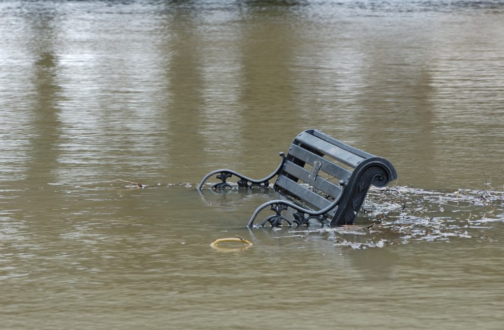
Image: Flooding caused by storm Eunice in South Yorkshire, February 2022.
While Eunice stole the headlines for wind strength and extensive damage that PriceWaterhouseCoopers has conservatively estimated at £350m, even before the power is reconnected to every home, it is Storm Franklin coming in at No.3 which perhaps best demonstrates the unpredictability of the results that we face as a nation.
Record River Levels
On paper, Franklin looked the weaker of the trio, but with the jet stream in such an agitated state, huge amounts of moisture have been carried across the Atlantic and dumped across parts of the North of England and North Wales.
The speed and severity of the river level rise has surprised many, with rainfall totals in excess of 100mm in under 24 hours in some places. Parts of the upper catchment of the River Severn have seen record levels. In Newtown in Mid Wales, the relatively juvenile river reached 4.106m (13.47 ft), eclipsing the record of 3.63m (11.9 ft) from 2008.
In Shrewsbury, it peaked at 5.15m at the Welsh Bridge, with severe flood warnings in place for Ironbridge and Bewdley as the bulge of water continues to head downstream. In Ironbridge, 60 properties have been evacuated at the time of writing as the river threatens to overwhelm defences that were put in place by the Environment Agency (EA)
Evacuations, Closures and Landslides
Tadcaster in Yorkshire has suffered its third significant flood in a decade, last affected by Storm Eva in 2015. While the river hasn’t risen as high as then, it has still led to many homes and businesses being evacuated once again, wondering when the promised extra flood defences will be finally delivered, after the EA had delayed their construction due to covid and complexities in the modelling of the scheme.
In Boston Spa, the weight of the water flowing along the River Wharfe cracked the road surface on the bridge connecting two parts of the town. It forced a temporary closure and an 8-mile round trip for residents to get from one side of the river to the other.
The River Don catchment, no stranger to repeated and heavy flooding, has again threatened Meadowhall Shopping Centre and flats in Sheffield, turned the tracks at Rotherham railway station into a canal and has pushed on down towards the long-suffering residents of Fishwick, who have only just got their lives back on track after the catastrophic flooding in 2019.
In the Keighley suburb of Riddlesden, the deluge saturated the bank above the River Aire making it highly unstable and causing a sudden and devastating landslide down into the torrent below. Dramatic pictures of the collapse in Westlea Road show how the houses are now perched perilously over the edge. With more rain forecast, the prospects of shoring up the slope seem slim as it is now highly exposed and vulnerable to more erosion. Fears are growing that the house and potentially others nearby could succumb.
These astonishing new examples have arisen for two key reasons – it has been a relatively drier winter and surface water has run into river catchments faster. Hard flood defences put in to protect residents in one location effectively funnel and magnify the problem quicker downstream, causing rapid rise. But the other factor is the ever-increasing amount of atmospheric moisture.
The front associated with Franklin brought very squally winds as expected, but it also came with a very marked convergence zone which concentrated very heavy rainfall in an intense short period.
Another Storm Surge
As Franklin passed across the country and into the North Sea, it generated another significant flood risk. In common, with many storm tracks this winter, higher pressure to the south has pushed storms along a north west to south easterly track from the Atlantic – as they cross the North Sea, they have created a series of tidal surges that have increased the number of Thames, Barking and Dartford flood barrier closures as they coincide with already high spring tides. 21st February was no exception.
The Thames Barrier closed for the 207th time in its history and Alan Atkin, one of the controllers at the Barrier, tweeted that they had made the right call as the height difference on the other side of the barrier at full closure was 3.6m, enough to have overtopped and inundated the centre of London. Downstream of the barrier, footage also emerged on social media of the river overtopping onto walkways along the river and in one instance completely filling a flood basin at Woolwich.
And in the Thames Estuary, the storm surge also brought flooding to Southend seafront and into the Medway flooding the Esplanade at Rochester and forcing the closure of the Pentagon Shopping Centre in Chatham.
After a relatively benign winter, we have now entered a more unstable, dynamic pattern of storms, with the prospect of more to follow as the jet stream continues to stay active. If it moves north like it was for much of December and January, we may be spared the worst, but any continuation of this conveyor of storms will keep accumulating rainfall in already highly saturated catchments, meaning little respite for affected households and businesses.
Recognising the Risks
It is well established now for conveyancers to investigate flood risk as part of their overall environmental due diligence with searches. As our climate changes, any stream, no matter how small, can become a raging torrent with highly localised, heavier deluges now a normal feature of our weather.
In line with the Law Society Practice Note on Flood Risk, Groundsure’s reports provide a comprehensive assessment of risk, as well as giving a view on the likely availability of affordable insurance. The availability of insurance can have a material effect on lending options, but there are also the wider mental health considerations of being out of a house or business premises for months waiting for it to dry out that can have an equal if not greater cost to clients.
Groundsure reports highlight flood risks and can help you make the right decisions when completing property transactions. Check out our Flood and Avista reports for residential transactions, or our Review report for commercial transactions.
References
https://www.harrogateadvertiser.co.uk/news/transport/update-boston-spa-bridge-reopens-3578214
https://www.echo-news.co.uk/news/19940946.southend-seafront-tidal-surge-leads-flooding/
https://www.kentonline.co.uk/kent/news/pentagon-evacuated-as-flooding-hits-towns-262847/
https://twitter.com/AlanBarrierEA/status/1495793064861917191?t=7hOlAg82NCNczrVQd8X0jA&s=19
https://twitter.com/pinksammi/status/1495805146999230464?t=kqcAdROMPlcv5USXqM3ttg&s=19
Share:
Date:
Feb 22, 2022
Author:
David Kempster