
Yorkshire has a long and proud coal mining history, but it has played host to a far wider range of other mining and excavation.
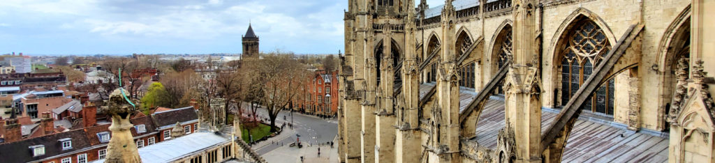
The city of York sits within a vale of glacial gravels, sands and clays that has proved to be rich pickings to equip the urbanisation and industrialisation of the major population centres that surrounds it.
In our latest case study ‘York: Clay Pits and Climate Change – Mapping the Risks’, we explore how as the city has grown and covered over an extensive legacy of potential hazards that could increasingly reveal themselves as our climate changes.
The nature of the underlying solid bedrock of the Vale of York means that metalliferous minerals, coal deposits and surface outcrops of suitable building stone for quarrying are largely absent. However, clay has been used for the widespread manufacture of bricks, with sands and gravels used in aggregates.
The Hidden Hazards of Hob Moor
Hob Moor in the southwestern part of the city represents a particular hotspot of past quarrying activity which has also been extensively redeveloped in recent decades.
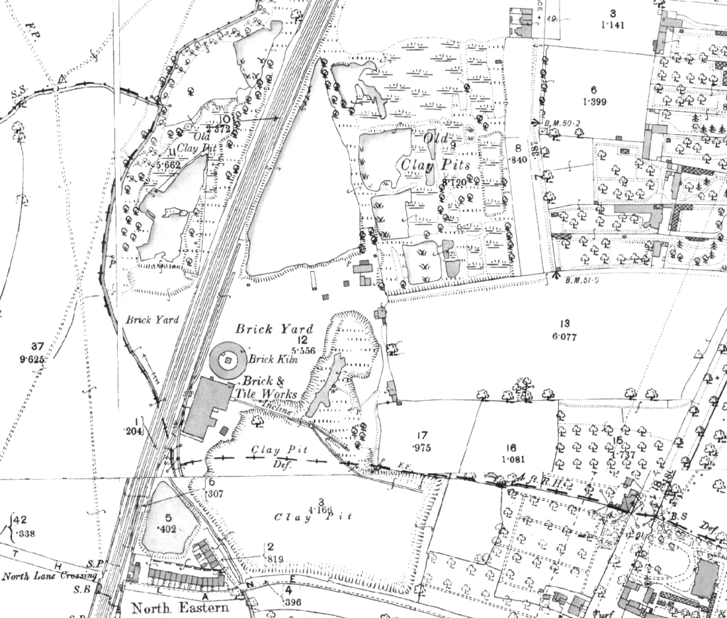
Figure 1: Extract from 1892 Ordnance Survey
Historic Ordnance Survey mapping first records the clay workings as a series of small pits and brickfields bisected by the railway running northeast-southwest across the area. These workings had expanded significantly by the late 19th century, encompassing a “Brick & Tile Works” and “Brick Kiln” with numerous large pits, flooded by groundwater.
By the early 20th century, the clay extraction appears to have ceased and the land gradually became occupied by the railway as sidings. Residential expansion of the area began in the mid-20th century and now occupies a significant area formerly occupied by the clay pits, as shown in Figure 2.
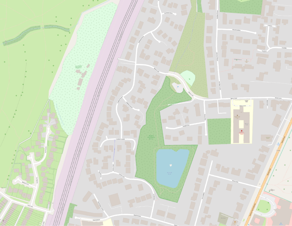
Figure 2: Extract from Open Street Map, showing housing development
A nature reserve containing a pond and other green spaces have also been created from formerly worked areas.
Shrink-Swell Subsidence and Climate Change
Much of the former extraction sites have been infilled, particularly to the north of the site but the depth and standard of their remediation before properties were built around and on top of them may not be well recorded. This represents a significant ongoing settlement and subsidence risk which may be compounded by forward climate change. It is well understood that periods of intense surface rainfall and flooding can saturate and mobilise soils and sands.
This can be especially the case at the edge of former quarry faces and where infill materials were informal and not to the standards required today. The swell of moisture can exert lifting pressures on structures, while equally, long periods of dry weather can exert shrink that leads to settlement revealed by slumping and lateral cracks in the building fabric. The alluvium and laminated clays in the Vale of York are especially susceptible to this and the subsidence impacts can be magnified by former extraction.
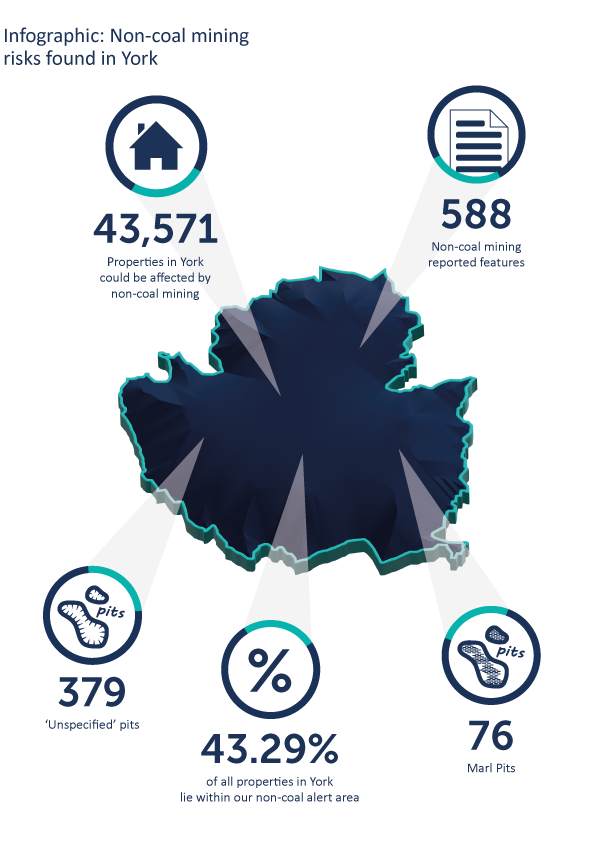
Looking forward, our climate will deliver greater extremes of wetter winters and drier summers which could have significant impacts on properties built over former quarries and pits. Hob Moor is not alone as a location across the City of York – our exclusive analysis reveals that some 43% of the municipal area is affected by former mining not associated with coal. This is nearly twice that associated with former coal mining.
Protecting Your Client on All Mining Risks
Conveyancers are familiar with obtaining a CON29M search for properties in a coal mining area but many overlook the more extensive legacy of other mining types. Our white paper shows have many properties across our major towns and cities could be affected by other mining than coal, in some cases two to three times that of coal mining in the local area.
Our Avista report provides ten key environmental searches in one, allowing full due diligence on flooding, contaminated land and other matters, together with full mining data that covers both coal and other types of former mining to ensure all eventualities are covered.
Using our vast resource of information, backed up by our expert interpretation, Groundsure’s Mining Consultancy Team is able to provide detailed research into the history of a region, specifically with regard to mining and other extractive industries.
We are able to deliver the best insight for clients and assess any risk more accurately and intelligently.
For enquiries in areas similar to York, we are able to identify land that has been worked for clay prior to more recent residential development. Understanding which areas of the former clay pits have been historically backfilled compared to those that remain exposed or continue to have a visible face, will significantly enhance the clarity of the risk assessment and any advice.
Equally, we can put clients’ minds at rest on the location of the property in relation to mined features, together with any required site inspections to ensure that transactions are able to continue smoothly.
For more information regarding Groundsure Geology and Mining Data Consultancy and our Avista report contact us on 01273 257 755 or email [email protected].
Resources:
City of York Council – https://www.york.gov.uk/
City of York Council, Hob Moor – https://www.york.gov.uk/downloads/file/1088/area-29-hob-moor