

The hidden dangers of old mine workings

It was reported1 earlier today, that an unfortunate incident occurred with a farmer sadly being injured after falling into a sinkhole.
The description of such hole is reported by the BBC as “a narrow throat, and then there was a large bulbous bottom”. Our mining experts instantly knew this related to an iron ore bell pit.
Stank, where the incident occurred, falls within Southern Lakeland, where large scale mining took place between the towns of Barrow and Ulverston. Stank is one of many areas where major ore deposits were situated and was the home of one of the largest pits – Woodbine Pit, which closed in 1946.
The use of bell pits was a common technique used in early iron extraction. Once exploited these were backfilled with loose organic material, which when loaded have the capability for collapsing. At the time when bell pits were used there was no legal obligation to represent these on mine plans, as such the workings of this era are poorly recorded. They do sometimes appear on older paper geological maps, as annotations, but with little or no specific location information. In these situations our mining experts consult additional sources such as Lidar and other satellite monitoring information from SatSense. In order to accurately assess these types of situations, multiple sources must be consulted in collaboration with one another.
We have also consulted our comprehensive collection of digitised mine plans and historic Ordnance Survey maps, which show later workings and a wealth of tunnels running underneath the farm and associated fields.
We wish the farmer a speedy recovery. This event highlights the importance of understanding the ground conditions at any site, whether that be a property or open farmland. Our suite of GeoRisk reports, which are compiled using our extensive collection of mining data and written by mining experts, aid in the identification of such risks.
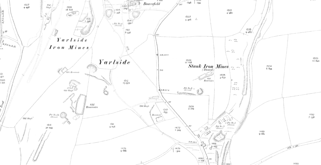
Historic Ordnance Survey Map from 1913 showing numerous pits and iron mines
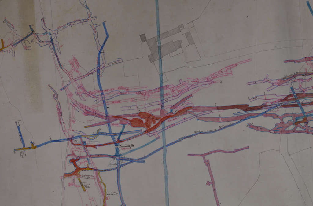
Extract of a mine plan from the Cumbrian Record Office showing the underground mine workings around Bowesfield Farm, Stank
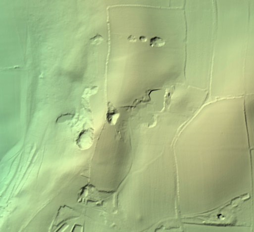
Environment Agency LiDar data
This article was written by Catherine Shiers, Technical Communications Manager, and Tom Harvey-James, Search Writer.
References:
Share:
Date:
Mar 5, 2021
Author:
Catherine Shiers