No longer the bridesmaid.

A bit of history to start off with…
Groundsure has served data products to the environmental consultancy and assessment industry for around 14 years.
However, Groundsure as a business has existed for quite a bit longer – ever since we began delivering environmental searches in 2001 and subsequently acquired our unmatched collection of historical Ordnance Survey maps. Dating back to the 1840s and scanned to a high quality, these maps form the basis of our existence and of our original business focus – delivering opinion on the risk presented to property by land contamination from past land use to the conveyancing industry.
In creating products for this initial target market we began to collate and curate environmental data on a massive scale. Data obtained from data authorities, and data generated internally. It wasn’t long before we began looking for opportunities in parallel markets… and so Groundsure Insight was born. By simply removing the interpretation from our conveyancing reports we could provide data-only products to other environmental professionals, giving them the raw material with which to make their own assessments and opinion. It was an easy and logical step for us to take. We of course bolstered this new offering with some more detailed and appropriate data, and for the next 14 years our Groundsure Insight ‘data-only’ products slowly gained admirers – and a decent level of success was achieved. We gained a foothold in a market that was previously a monopoly. Everyone was satisfied, and so it went.
Fast-forwarding to the present, we have undergone a transformation in recent years. In line with changing customer expectations, Groundsure has invested in its product future, focusing with obsession on the customer, their experience and the value we provide. As is the way in this hard-nosed, financially driven world we addressed our most valuable markets first, conveyancing, and in the process revolutionised environmental searches with our premium and ground-breaking Avista product.
Now we turn our attention to our Groundsure Insight offering. In our new world of product excellence, the perfectly adequate reports we had been serving our customers were no longer deemed fit and have gone through a complete review. These products have finally received their due attention (rather than being any sort of after-thought or by-product as was their origin) and sequential phases of research across the past year or so have allowed us to focus down into the best deliverable value to the customer.

So, how have we improved our product offering?
It boils down to “how can we help?” In this particular marketplace the answer is two-fold; time and cost savings. We save our customers time by collating and curating hundreds of datasets that would otherwise need lengthy and complex acquisition, licensing and processing before they became anywhere near usable. (Of course, we also have many unique and proprietary datasets not available elsewhere.)
Our data content covers *deep breath* historical land uses, landfill and waste sites, permits, licences and other regulator records of potentially contaminative activity, geology, hydrogeology, hydrology, flooding, natural environmental hazards, ecology and areas of environmental sensitivity; all collected and curated from national, regional and local data providers.
In this newly launched upgrade we have added c.70 new datasets, including many vital and valuable additions available nowhere else. Data such as: Pollution Inventory, Waste Exemptions, Groundwater Vulnerability, Water Frameworks Directive data, Ambiental flood data, Agricultural Land Classifications, Stewardship Schemes, Countryside Rights of Way (CRoW) data, visual and cultural designations (e.g. Conservation Areas, Listed Buildings), enhanced environmental designations data, habitat assessments, Royal Mail Tunnels and Historical Mineral Planning areas; to name but a few!
More data is great (if useful) and the content we have added will allow you to report more effectively and comprehensively on matters relating to your site or project.
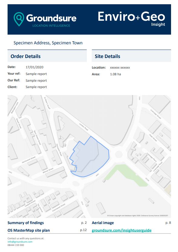
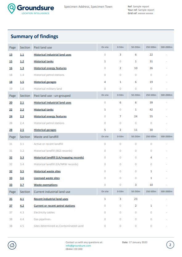
But how we can really increase the time we save our customers is in the usability of our products – and that is where we have taken a huge leap forwards with these new reports. They are now full of features to enable efficient navigation, speeding up the identification and assessment of the significant issues for your site; whilst improved data styling, modern background mapping, enhanced feature labelling and dynamic map legends all combine to provide a clear visual display of identified data.

The future is… Portable Document Format?
But really? More PDFs? You may be reading this thinking this is hardly ground-breaking stuff. I hear you.
In conversation with our customers (and validated in research) we are very aware of the industry shift towards digital consumption and interrogation of data – and we will be driving that change with upcoming developments. We are also aware however that this is a slow transition and will continue to be, for as long as the need for portable, transferrable evidence remains in its current guise.
What we have developed in our new reports is ‘peak PDF’. We have optimised and created marginal gains within the confines of the medium. The big changes are still to come, but the new Groundsure Insight reports will certainly allow you to better enjoy (or endure) the slow death of the PDF.
I’m proud of these products, and I hope you will enjoy the benefits and savings they will give you. The improvements are particularly startling when comparing our old and new reports side-by-side. For our existing users – thank you for bearing with us. I hope you now feel suitably rewarded for your loyalty. For any prospective users – it’s time to take another look at Groundsure. We think you’ll be glad you did.
Find out more about our new and improved Insight reports here.
Date:
Feb 3, 2020
Author:
Dominic Tubb

