

How understanding the geology can help with your site investigation
Groundsure recently invited industry partners, the British Geological Survey (BGS) to co-host a webinar exploring the critical role of geological insight in site investigations. Their expert team demonstrated why having a clear understanding of geological conditions is essential before any physical ground investigations begin.
Held in mid-February, the webinar with industry partners the British Geological Survey focused on a simple but critical truth: successful site investigation starts long before anyone sets foot on site. Understanding the ground beneath a development relies on robust geological data, drawn from multiple trusted sources and carefully interpreted together to form a coherent, reliable picture of subsurface conditions.
At Groundsure, we use many of the same datasets referenced by the BGS, both in our own technical assessments and in the products that we provide to our customers. These data sources are fundamental to identifying ground risks at an early stage, reducing uncertainty, and supporting safer, more efficient groundworks.
We bring multiple datasets together
No single dataset can fully capture the complexity of the ground. Instead, true value comes from integrating multiple sources, each providing a different perspective on site conditions.
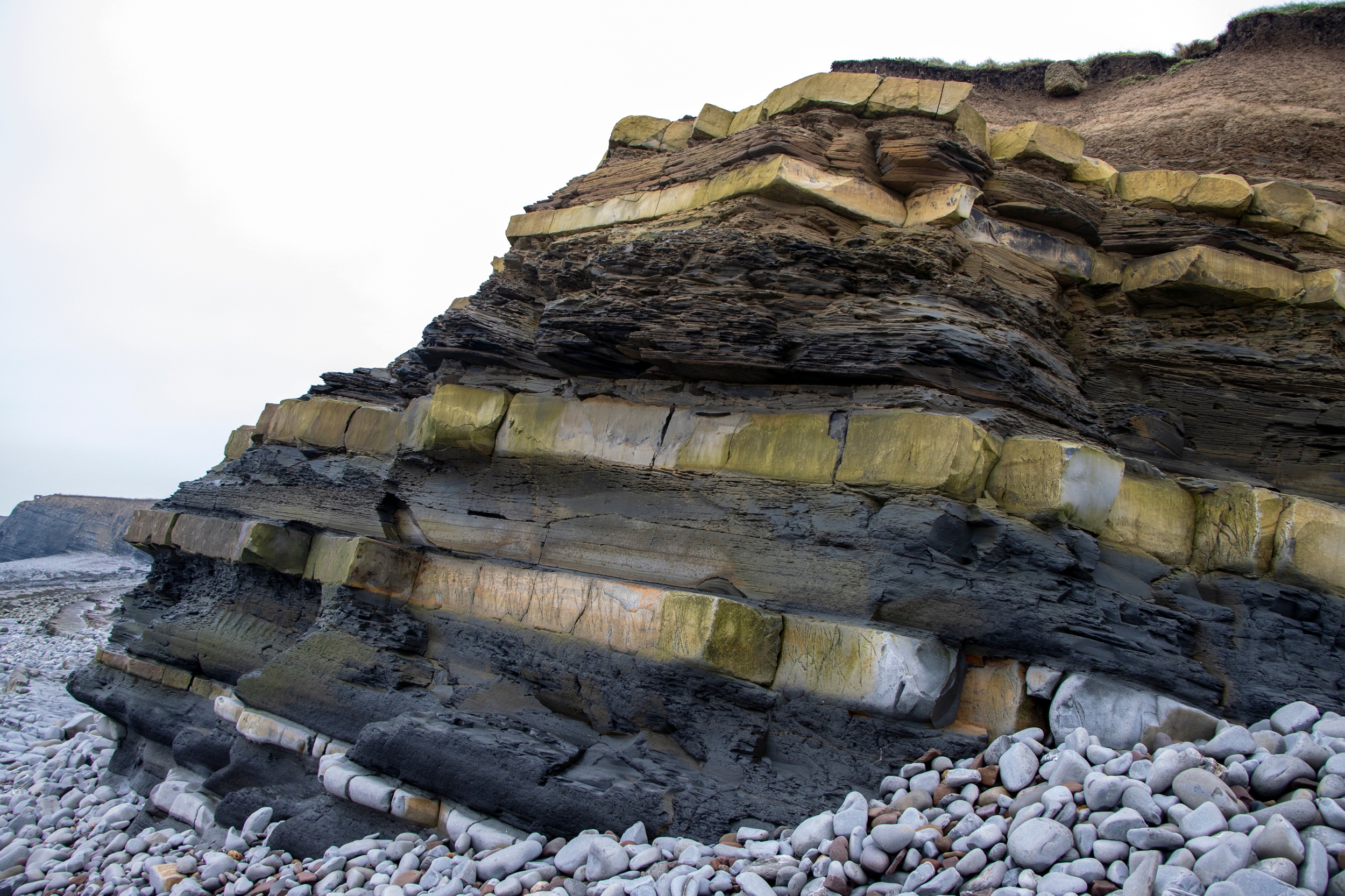
LiDAR data – offers high-resolution elevation models that reveal subtle changes at ground level. These can indicate former land use, made ground, erosion features, historic quarrying, or shallow landslide scars that may not be visible during a site walkover.
Field slips and mapping observations – those recorded by geologists provide vital insights into soil and rock types, superficial deposits, and structural features. These observations underpin geological mapping and help validate interpretations derived from remote sensing and modelling.
Historic maps – these are particularly valuable for understanding how a site has changed over time. They can identify infilled ponds, former industrial land or historic mining activity, all of which may present geotechnical or environmental risks today.
Borehole logs – provide direct evidence of subsurface conditions, recording soil and rock sequences, groundwater strikes, and geotechnical properties. When viewed collectively, historic borehole data can significantly improve confidence in ground models and help target intrusive investigations more effectively.
Geophysical data – helps fill the gaps between boreholes, helping to identify anomalies such as voids, buried structures, variable ground conditions, or changes in bedrock depth. When used correctly, this data can reduce uncertainty and optimise investigation design.
Individually, each dataset is useful. Integrated, they deliver robust ground intelligence.
Understanding geohazards early
One of the greatest benefits of using BGS-derived geological data is the ability to identify geohazards at an early stage, when risks can still be managed cost-effectively. Some examples of such risks are included below:
Radon: a naturally occurring radioactive gas linked to underlying geology. Understanding radon potential early, allows appropriate protection measures to be designed into developments, thus avoiding any costly retrofits.
Mining-related subsidence: remains a significant risk across many parts of the UK. Historic mining records, geological mapping, and borehole data can help highlight areas where ground instability or shallow workings may pose a risk to foundations or services.
Landslides and slope instability: these are often controlled by geology, groundwater, and topography. LiDAR and mapping data can identify historic movement and susceptible ground conditions, by informing slope design and drainage strategies.
Sinkholes and dissolution features: can pose sudden and severe risks – particularly in areas underlain by soluble rocks such as chalk or gypsum. Geological models and borehole records help identify the areas where these hazards are more likely to occur.
Erosion and ground degradation: these are closely linked to geological conditions and historic land use – whether via coastal or fluvial processes. By understanding these processes, it supports better long-term asset and infrastructure planning.
By identifying these hazards early on, project teams can make informed decisions about the investigation scope, the foundation design, and risk mitigation, and explore site investigation geology, rather than reacting to any surprises once groundworks are underway.
Going from data to decisions
- Whether planning an initial desktop study, or scoping intrusive investigations, or assessing long-term ground risk, getting a solid understanding of geology puts you in a far stronger position
- At Groundsure, we integrate BGS datasets with other environmental and geotechnical information to support both our internal assessments and our customers’ decision-making
- Our reports are designed to translate complex geological data into clear, practical insights that can be acted upon with confidence.
Supporting your projects
If you’re looking to explore geological risks and the ground conditions for your sites, our products can help you.
| Geo Insight Geo Insight provides comprehensive, consultant-ready assessments that integrate geological data with environmental risk analysis from various sources. It combines 10k BGS geology data as standard. Learn more here | Groundsure Explorer Explorer will streamline your workflow and elevate your decision-making. It brings 170+ years of mapping history and 130+ datasets to your fingertips. Learn more here |
To find out how our data-driven insights can support your next project, contact our Customer Support team on 01273 257755 or email: info@groundsure.com
Share:
Date:
Feb 12, 2026
Author:
Tom Harvey-James