

Historical maps and why they are an important consideration when redeveloping a brownfield (or greenfield) site
It is important that the acquisition of any greenfield or brownfield site should be supported by, at minimum, an environmental desktop study of the site.
It is essential to be aware of any potential environmental liability that may be associated with a site prior to purchasing it.
This is particularly relevant when a site is to be redeveloped as it is often a requirement to conduct a desktop study and submit it to the Local Planning Authority1.
An important part of a desktop study is the investigation of historical land uses of a study site in order to understand any potentially contaminative activities that may have occurred on site. Paul Syms (2010) states that any developer or planning officer should be extremely cautious of a site investigation report that does not contain a historical study. Failure to recognise the risks associated with the past use of a site and the site conditions can result in damage to a company’s reputation and financial penalties 2.

The historical section of a site investigation primarily involves the analysis of historical mapping in order to understand how and when an area of land has been developed over the years. Several phases of development may have occurred at a study site in the 19th and 20th centuries and assessing mapping over this time period may identify land uses of concern (for example tanneries, foundries, leather works or cotton mills). Additionally earthworks and other changes to physical features may have taken place over a period of time that can indicate the need for further investigation. Surface water features and watercourses may have been infilled or buried; heaps may have been levelled and site levels may have undergone significant change2. So not only does a desk based environmental study give an indication of past land uses and thus any risks for contamination but it may give an idea of any potential man-made stability risks, essential when looking to develop a property on site. The historical maps can also provide valuable information regarding potential geotechnical hazards, such as the presence of previous swampy ground, old mining activities and quarries 2.
Historical Ordnance Survey Maps and Data from Groundsure
Compiling a historical study used to be time-consuming and expensive. It required many hours spent in planning authority offices, study centres and local history libraries. It also required review of files and records available at the Environment Agency and environmental health departments of local authorities. Conducting historical research today is much simpler. Groundsure maps and data provide developers, geotechnical consultants, architects and environmental consultants with the information they need to carry out a thorough historical study and, consequently, a good site investigation.
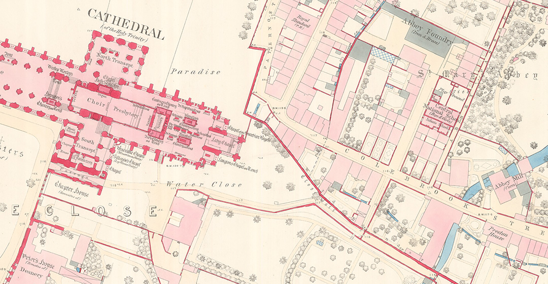
Groundsure MapInsight contains the clearest, most comprehensive collection of Ordnance Survey National Grid, County Series mapping at 1:10,000, 1:10,560, 1:2,500, 1:1,250, 1:1,056, 1:528 and 1:500 scales. The maps date back to the 1840s to provide detailed insight into historical land use to understand the potential contaminated land risks and associated liabilities. Additionally, Groundsure historical maps are scanned at over 500 dots per inch (dpi) and provide a high level of quality and accuracy, meaning that the understanding of information is more immediate and the subsequent analysis is easier, faster and more accurate. Each Map Insight is manually assessed by an in-house GIS consultant before delivery, to make sure the maps of historical land use accurately reflect the study site. Groundsure also includes the original marginalia information (mapping dates including published, survey, revision and copyright where available).

The importance of good desk study information into the background history of any site prior to the commencement of works is vitally important. High quality historical mapping and data comprise the first phase of a good site investigation and help architects, developers and consultants identify target areas for more detailed investigation.
References
- EUGRIS, n.d. Site Investigation: Overview [online] Available at: http://www.eugris.info/FurtherDescription.asp?e=47&Ca=2&Cy=0&T=Site%20investigation [Accessed 7 July 2016].
- Syms, P., 2010. Land, Development and Design. [e-book] West Sussex: Wiley-Blackwell.
Share:
Date:
Nov 11, 2016
Author:
Stephen Sykes