Lorem ipsum dolor inset gitatur arciis reped et asit latibus rem fuga utati estemqu atisima gnimusa.

Lorem ipsum dolor inset gitatur arciis reped et asit latibus rem fuga utati estemqu.

Our products

Fire Insurance Plans

£20 +VAT

Historic building plans for clearer contaminated land assessments

About Fire Insurance Plans

Fire Insurance Plans provide high-resolution historic building plans produced between 1878 and 1970. Featuring Charles E. Goad plans, these maps show detailed information on building type, and use, materials used, presence of asbestos, tanks etc to deliver clearer, context-rich insights for more accurate contamination risk assessments.

Detailed industrial context

Identifies building materials, water supplies, and fire hazards for clearer risk assessment.

Large coverage

Available for sites up to 2ha and covers most major UK cities including Manchester, Coventry and London.

Complete site view

Any gaps in historical mapping are filled with our contemporary mapping.

Related products

Trusted environmental data, designed to support smarter land and property decisions.

Enviro Insight

Essential for Environmental Consultant’s desktop study

Groundsure Insight

The ultimate due diligence package: Enviro, Geo & Map Insight reports

Map Insight

The definitive historical map report essential for geo-environmental professionals

Product spotlight:

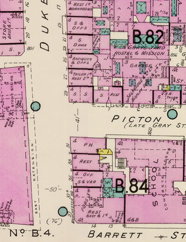
Charles E. Goad fire insurance plans provide detailed contamination risk insights, mapping building materials, water supplies, and fire hazards.

Produced at 1:480 scale between 1878–1970, coverage spans most major UK cities such as Manchester, Coventry, Sheffield, Plymouth, Cardiff, London, and Glasgow.

EllenRichardson-GroundsureTeamFeb2026-47

Speak to us

If you still need help and guidance on the Fire Insurance Plans product, our experienced Customer Support team will be happy to help you. Contact us via the form or call us on 01273 257755.

What our clients say...

Our products

Our services

About us

Resources

News & insights

Our products