In this blog post, we introduce a practical solution designed to help ecologists streamline their tasks, reclaim time back and help them overcome barriers and the layers of complexity that often slows down progress in desktop studies and reports.
The lengthy planning and desk study process
The ecology desk study preparation stage requires ecologists to gather data and records from multiple sources. Information is often presented in different formats, and inconsistencies can create complexity, delays and frustration – this doesn’t create an ideal workflow. At Groundsure, we understand the importance of collating biological records in informing UK conservation, research, planning, the decision-making and policy purposes.
The research highlighted below contributes to wider industry discussions on how nature is considered at the planning stage. It aims to help remove barriers and improve the data-gathering process – spending less time gathering information and more time delivering insight.
Turning ecological insight into better planning decisions…
According to research by the Association of Local Environmental Records Centres (ALERC), over the last five years, the average number of applications in England that are informed by a Local Environmental Records Centres (LERC) data search has consistently been below 10% – according to research published. ALERC recommends consulting relevant Local Environmental Record Centre’s evidence base as a requirement for developments with potential impact on biodiversity.
- Research presented by ALERC in 2026, highlights that appropriate ecological evidence is absent in the majority of planning applications;
- Statistics show only 1.7% planning applications in London are informed by Local Environmental Record Centres in 2024-2025;
- Yet, in February 2024, Biodiversity Net Gain (BNG) became mandatory in England, to increase the use of biodiversity data in planning stages and decision-making;
- Following this, ALERC expected the increased use of biodiversity data used in planning and decision-making, which hasn’t been the case.
Groundsure is a leading UK environmental and climate data authority – we have 25 years experience in giving land and property professionals expert information on risks. As a leading UK environmental and climate data provider, we’ve developed a practical solution – Ecology Insight to help ecologists save time by efficiently filling species-record gaps and informing ecological desk studies with relevant available data. We hope to support the gaps in LERC data by clearly signposting the relevant LERC searches within our reports.
Over the last 12-months, we have spoken to ecology professionals and our research suggests that the delays ecologists experience are primarily driven by the time it takes to gather the information needed for desktop reports.
Amina, a Senior Ecologist says when talking about data collection: “It can range from 24-hours, to over a month in some cases, which creates delays to the project delivery.”
Our discussions with ecologists highlighted how inconsistencies in data capture and presentation can create further challenges, increasing the time needed to complete desktop studies. Amina says: “Desktop studies can take from a couple of hours to a full day, depending on both the format and quality of the records received. If the records are supplied in PDF format or the datasets are not clearly organised, then considerably more time can be needed to extract the information.”
But what if you could collate datasets together, and eliminate manual extraction from other sources with ease?
Introducing Groundsure Ecology Insight…
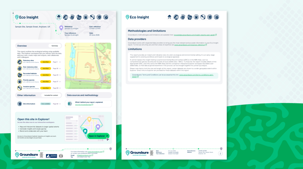
The Groundsure Ecology Insight combines a structured desk-based ecology baseline report, with interactive spatial mapping tools.
Here’s how it can help you:
- We’ve combined 41 national datasets that many ecologists will be familiar with, such as the Environment Agency, the Forestry Commission, Natural England and NBN Atlas;
- Our partnership with GetMapping provides access to high resolution aerial photography;
- Access to highly detailed water course data and comprehensive site context from the Ordnance Survey®
- Our datasets also include other premium datasets that are not readily available elsewhere – but would provide significant benefits to an ecologist’s workload.
Amnia and her team used the Ecology Insight product on a live project in 2026. She said: “Ecology Insight saved us approximately two hours of work during the survey planning stage. Having all the information together in one place was particularly valuable when viewing building placements for mapping habitats. We also found the aerial imagery function useful, as it allowed us to overlay three types of mapping within one workspace. Previously we’ve relied on freely available satellite imagery.”
Groundsure Ecology Insight – essential information:
- Groundsure Ecology Insight – provides 1km of data search;
- Cost: £50 + VAT and a delivery time of 4 hours;
- 41 national datasets into a singular report – enabling initial screening and visibility of site conditions. This can be shared with site developers and project teams by using accompanying online workspace, Groundsure Explorer;
- Provides consistent and fast reporting of openly available species records – across England;
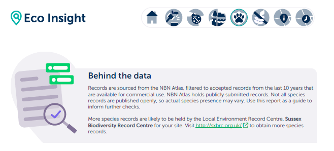
- Although our product doesn’t contain LERC data, we provide full sign-posting to the relevant, full LERC searches within the Eco Insight PDF.
- By doing this, we hope to help increase use of biodiversity data in planning stages and decision-making and support the ALERC.
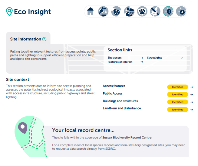
Below: Examples of sign posting to the Local Environmental Record Centres (LERC) in our product report.
If you’d like to have an informal chat about the Ecology Insight report and discover how it can help you, contact us on [email protected]
Learn more about the report here.
*When compared to Greenspace Information for Greater London (GiGil) & Doncaster Local Records Centre with an average delivery time of 10-working days.