
Mining Searches UK are the leading specialist in mining site investigation and reporting. We are continually innovating to ensure we can provide the most robust assessment for our clients.
On a recent site, Gwallon Keas (200 house development) for Devonshire Homes, we have been using innovative 3D CAD plans for our site assessment.
Take up of this option was not the natural choice for our client, as it was something new, but following our expertise in explaining what was needed and why, the customer was on board.
Initially, our geologist Aaron Moyle was having to provide draft 2D sections each time a phase of drilling was completed. This made it difficult for others to understand how the mining features identified were connected and how they affected the site as a whole. However, with some manipulation these plans could be shown in 3D.
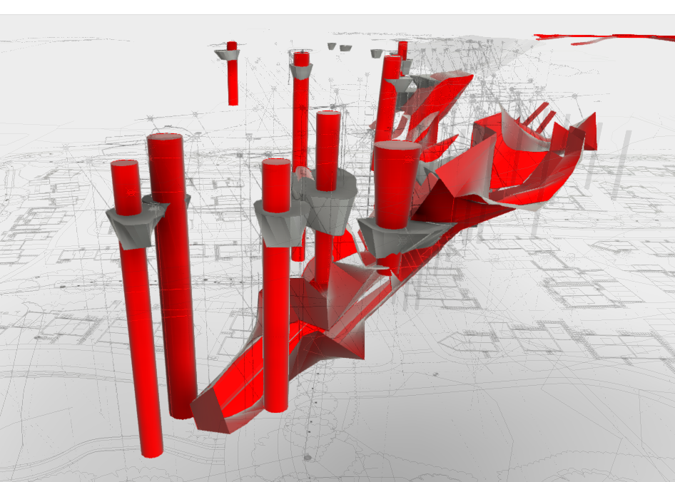
Alongside the 2D drawings, Aaron updated a 3D model of the site following each phase of investigation. This was freely available to our client using an online viewer. This 3D model was georeferenced and to scale, meaning the interpretations of the mine workings could be easily viewed in relation to the proposed site layout. This subsequently affected the clients proposed build program so that the high-risk area could be initially avoided to allow for construction and sale of plots in areas of the site not affected by mining.
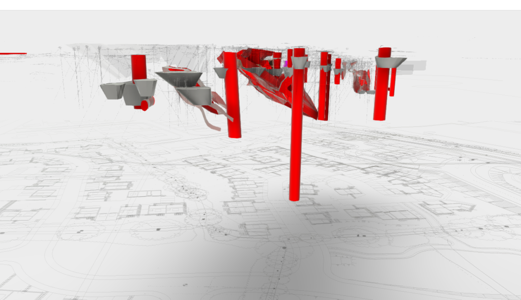
The 3D model now has over 20 revisions, which the client can view at any time, accessible on desktop PC’s, tablets or on their phones as they walk across the site. It is regularly used by the client and has been used in multiple meetings onsite with directors and investors to demonstrate the mining risk and present remediation methods. Following a site visit and presentation, Phill Heard – Senior Site Manager at the time of the project, Devonshire Homes said: ‘The board of directors have been complimenting the efforts that have been made by Aaron. Our visit on site today went very well and there was a great deal of positive feedback.’

In addition to data collected by MSUK onsite, Aaron also added publicly available LIDAR data to the 3D model from Defra Data Download. He downloaded point cloud LIDAR data for the site prior to construction beginning (2011 dataset). Following manipulation of the data it was possible to visibly identify areas of the site which showed signs of subsidence or uneven ground. This was used to successfully identify multiple anomalies which related to unrecorded shafts and shallow mine workings without any further site investigation works being required.
3D model – concrete plugs installed to secure mining features
The benefits of the 3D modelling go beyond just this one site. It allows for easy visualisations of any site investigation results and interpretation of mine workings. It’s easier to understand the extent and size of mine workings when they can be viewed in 3D. 3D software allows for easy modelling of data, quick interpretation and prediction of the extent of mine workings. LIDAR data can be used to identify high risk areas prior to any onsite works being conducted and using A360 online site, clients can view the 3D models we share for free whenever they want.
Mining Searches UK is the country’s leading specialist in historical mining risk. Combined with Groundsure, leading environmental search specialist, their team of geo-environmental experts and geospatial data scientists provide you with advice and information products across the spectrum of geo-environmental risks. Click here to find out more.