
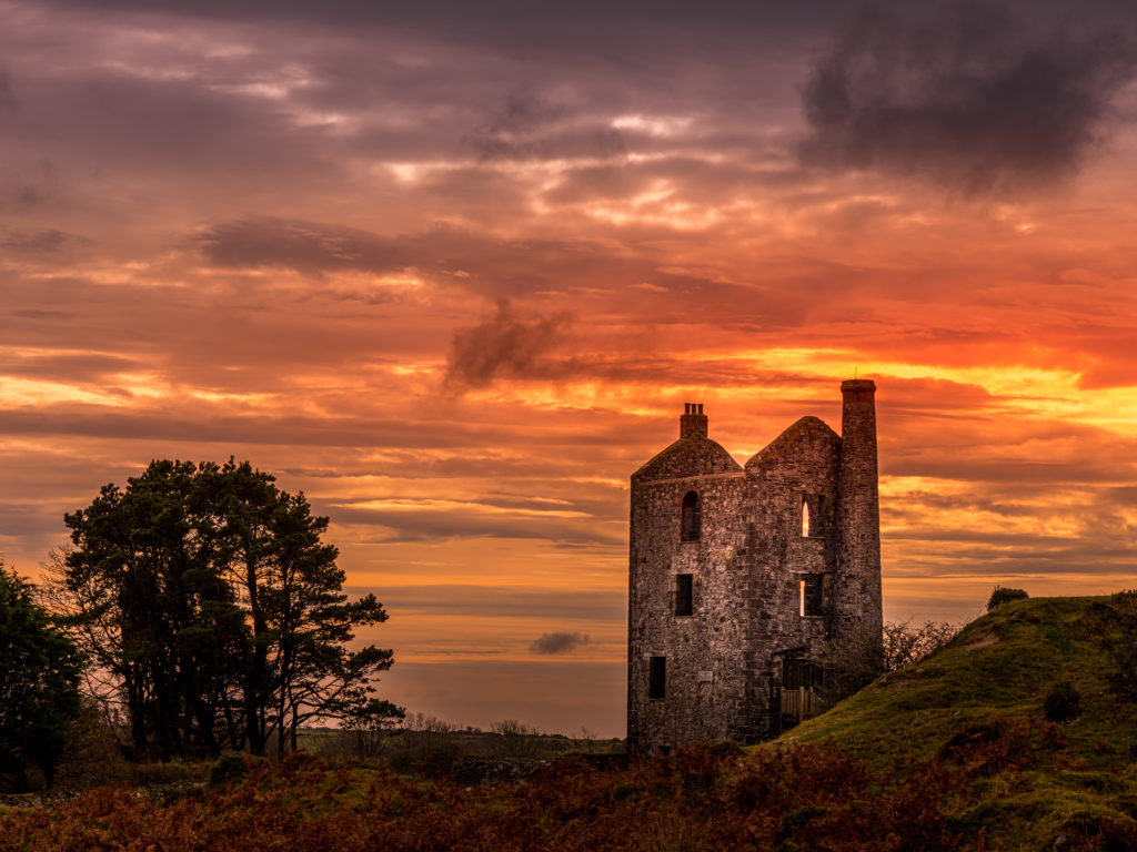
Living in Cornwall, you get used to the sight of engine houses towering over the sea, some of them becoming National Trust museums, or areas of heritage and Outstanding Natural Beauty, others left to crumble into the countryside. There is also some general consensus that the shafts left behind, as well as adit portals, which can be seen disappearing into cliffs all across Cornwall are usually something to ignore, and not go near lest someone falls into them.
This was certainly the case while I was growing up. We would often walk our dogs across the spoil tips near Geevor, or through the Arsenic Ovens at Botallack, enjoying dashing through the tunnels and ruins – I now often take my own daughter here, watching her as she enjoys the same Ovens I once used to dart in and out of. However, Adits and Shafts were kept out of bounds.
The older I became, the more I started exploring places that I considered historically interesting, from Workhouses, to World War II bunkers and airfields, any kind of abandoned industrial sites got the better of me.
Fast forwarding a few years, to when I began working with Groundsure. Through listening to the Geologists and Mining Searches writers discussing the historical mining across Cornwall, my interest had peaked once again. It is amazing to see how the extent of what lies beneath is so different from what we see above ground.
A fantastic example of this can be found in the museum of Geevor tin mine, where a 3D wire representation of the mine workings is displayed, showing the surface site, and the miles of tunnels and workings that carry on beneath both land and sea. There are approximately 85 Miles of tunnels (which, in a straight line, would take you from Penzance to Plymouth) producing 50,000 tonnes of Black Tin. It perfectly demonstrates how, even in areas where there are no visible signs of mining, there is still the possibility of workings that have been driven far beyond the bounds of any engine house, or mine site situated above ground.
As part of my role, I was taught how to use QGIS – a database that compiles historical maps and plans of mines across Cornwall and the rest of the country. Suddenly, the small holes in the cliffs a few miles from my house, which I always assumed only went a few metres before stopping, now apparently stretched for miles underground, and that’s just the Adits! Not to mention the multitude of further tunnels and levels that honeycomb the ground beneath our feet.
My interest with mining and its history continues to grow with every discussion with my colleagues. The history and geology of Cornish tin mines really makes ‘everyday a school day’.
Learning how they directly affect conveyancing and property buying today, with mining searches a standard requirement in Cornwall, together with many accounts of old unknown shafts opening in roads, gardens, car parks or fields, has breathed life into mines that I feel get mostly forgotten. This makes Cornwall’s rich mining legacy still relevant and important today.
Within the Groundsure Geology team, we regularly discuss with clients the impact that an adit snaking its way underground may potentially have on their house, possibly leading to subsidence and insurance/ Mortgage issues. Like that house, this tunnel, at one point or another, was someone’s whole life, spending entire days shuffling in the semi-dark, chasing veins rich in Minerals.
Sentiment aside, I now have the understanding that finding the right entrance and given the right circumstances (always making sure my safety is a priority) I could explore some of these mines and see a snapshot of what they might have seen 100 years ago.
“Finding the right entrance” – this was the hardest factor.
Given that on any stretch of Cornwall’s South West Coast, you will be able to spot tens of small holes leading into darkness, unknowing to what they hold. Some of these are like gold, leading you to huge areas where Mineralised Veins have been cut into a stope, and more tunnels (hopefully containing artefacts of the lives of these people), others will simply be exploratory drives, not going more than a few metres.
Situated on the south western side of the famous Cape Cornwall is Priest Cove, which features a tide pool, favoured by locals in the summer, a boat launch ramp, and several small adits, one famously gated off, as it only takes about five steps before it plunges into another shaft (once again filled with water, but this time at a stomach churning depth).
The Geologists however, had recently undertaken a drilling investigation in the area and I’d spent some time placing the relevant information into QGIS where I had spotted there was a separate Adit close by. It was recorded as not having a shaft on it and was driven a good way into the cliff beneath Cape Cornwall Golf Club. Confirmation that this was the entrance we wanted was when I saw a photo of the adit mouth, but with water still flowing from it.
One of the first things I learnt with Groundsure relating to mines, is that adits were in fact often drainage for the larger workings – this posited the fact that, if the water was still on, it was draining from a bigger area of the mine.
The entrance in question, from the information I could gather, was the deep adit level for St. Just Amalgamated Mines – a collection of smaller mines which eventually were all worked as one in the St. Just area. Knowing this information, I could look through a vast array of mine abandonment maps and plans for the area, and work out how viable it would be to explore. It turned out to be more than we were expecting.
Pushing more than 120 metres through the cliffs beneath the golf course, we discovered water up to our shins, tunnels which showed the miners’ stories – from shelves cut out of the tunnel sides, to small pockets of exploration where you could see they had chased the minerals for a short time before moving on.
Perhaps the most memorable part was the Stope we eventually walked out into. The adit path narrowed along the edge of a six foot drop, with 30 feet of fresh air above, tunnels leading off in front and below. Everything I had seen on a screen from the office was being translated into real life, and the scale and size of it all was something to behold. It also added credence to the work we do on a day to day basis, bringing home that when we report features (like shafts and stopes) just a handful of metres below a property, there is a real chance that someone’s home is just a handful of metres from mining heritage.
Sadly, this would be the limit of how far we could go for this adit, without better safety equipment. Studying the plan for the area, this was still only a small piece of the overall mine, only 120 feet of horizontal tunnel, of an over 160 fathoms deep mine, with further horizontal tunnels stretching all the way to the famous stack on Cape Cornwall Point, and under the golf course further inland, towards the mines of Boscean and Kenidjack Valley. Despite this, we were overjoyed by the amount we were able to see.
I think the biggest takeaway from this for me was the realisation that, from my growing interest in mining from the work I am doing in an office everyday, I had managed to translate what was discussed daily with clients, from small lines on a database, and text on a page, into a very real tangible thing, which you can see and smell.
This really drives home the importance of the mining searches and investigations that are carried out daily, seeing the size and the scope of what I usually see as “features” in a report for a client, into focus, giving them some substance and importance that they would have carried a hundred years ago for the people who worked them to today for the people living above them.
Find out more (link to mining risk assessments) about the work of our expert mining geology team, call us on 01273 257 755 or email [email protected]