

Early identification of protected species is crucial to securing planning consent. Conducting habitat surveys both within and beyond site boundaries helps ecologists understand the potential impact of a project and protect the welfare of the protected species in ecology.
In this blog post, we explore where bats thrive, why early detection matters and how ecologists can identify their presence with ease.
As bats are protected under British and European law, early identification helps ecologists streamline reporting and planning while managing client expectations – even when a Local Environmental Records Centre search isn’t required.
Bats (order Chiroptera)
According to the Woodland Trust, the UK is home to 18 species of bats. They’re all protected by law European Protected Species (EPS), under the Conservation of Habitats and Species Regulations 2017. This protection also extends to their breeding and resting places which include trees, hedgerows, watercourses and old buildings. These provide vital roosting sites, foraging opportunities and important navigation routes.
Where might bats be hiding?
Habitat examples include: Ancient woodland, meadows, cellars, old mines, caves and ice houses, large gardens in suburban and rural areas, and traditional timber-framed buildings such as barns.
Bats love older buildings
Older buildings are prime bat roosting habitats. The presence of older buildings on-site may indicate the need for the ecology surveys. Therefore, reviewing mapped buildings within and beyond the site boundary &/or statutory site can help ecologists assess the roost potential, alongside other relevant nearby features such as watercourses, woodland and streetlighting that may influence bat activity.
Boundaries and beyond
The example below shows a site map from a Preliminary Roost Assessment (PRA) that was undertaken within existing guidelines. However, it does not assess the potential for bat habitats in the buildings beyond the site boundary, despite it considering statutory sites within a 9.6k radius.
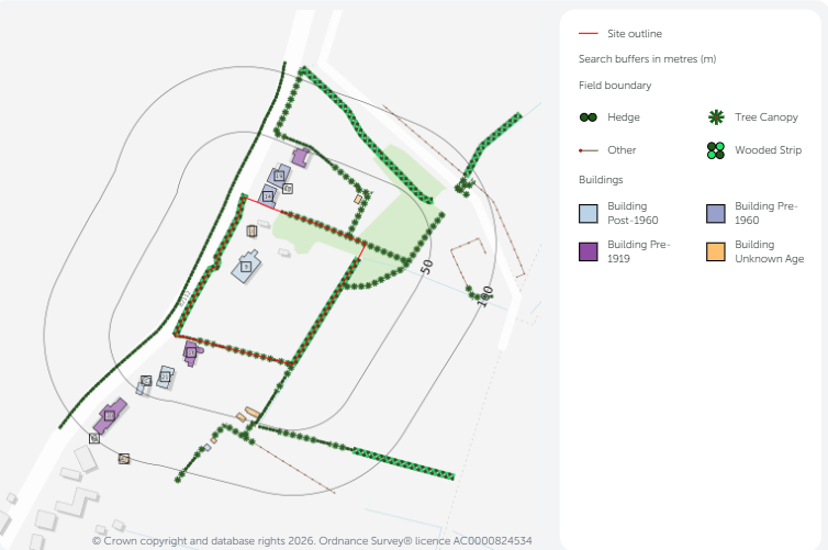
*Map created by Groundure using Ordnance Survey® data, from a planning application from 2024 of an interim bat survey report. Property location – Ditchling, East Sussex. Crown copyright & database rights 2026. Ordnance Survey licence AC0000824534.
Discover how Groundsure can help ecologists protect bat habitats
Groundsure Ecology Insight provides early visibility of site conditions. It combines a structured desk-based ecology baseline report with spatial mapping tools. Data is compiled into a singular report, to provide an initial screening of the site, that can be shared with site developers and project teams.
It includes the use of Ordnance Survey’s® National Geographic Database (NGD), collection of highly detailed topographic date, that includes:
- Water network – providing the flow direction of both named and unnamed water courses, and locations of water features such as lakes and ponds;
- Building information – access detailed data about any building on and around your site to understand roof shape, construction material, and period of build for the potential determination of roosting hot-spots.;
- Streetlights – visibility on street lighting location can be helpful for bat planning surveys, and where visibility may be impeded;
- Field boundaries – split into boundary types including, hedge and tree canopy, to help understand potential habitat locations, before you head on site.
Access the information you need in one report
- Records for Ecology Insight priority species are extracted from the National Biodiversity Network (NBN) Atlas – the UK’s largest collection of biodiversity information.
- We receive this information through their API – Application Programming Interface and get the latest view of their records and it presents records that have been submitted in the last 10 years.
- Groundsure’s Ecology Insight delivers clear location-specific findings through summaries, maps and evidence-led reporting. It helps ecologists access the information they need, faster.
- Ecology Insight is available before data searches from Local Environmental Records Centres (LERC), it supports the essential information needed (and doesn’t replace it).
Learn more here.
Find out more:
Book an informal chat about the Ecology Insight report and discover how it can help you, contact us on [email protected]
